Best of...

Showing posts with label gorgeous. Show all posts

Wednesday, March 23, 2011

Yellowstone Pictures, Pt. II

I’m over on the east coast, doing some family visits, and thought I’d use the occasion to post some photos from this past summer/fall, that have heretofore been unpublished. This first set is from a trip to Yellowstone – there are a few more pictures here.P1240403

The entrance sign near West Yellowstone, WY. (Which has an incredible 4th of July fireworks show!)

DSCF5084

Mud pots! (I bet that’d make a great face mask… not that I advise trying!)

DSCF5101

The view overlooking one of the geyser boardwalks. It was really comforting to think about so many people enjoying and learning about geology!

DSCF5113

Spasm Geyser.

DSCF5178

Near Prismatic Spring. (I overheard a private tour guide saying that the best viewpoint for Prismatic Spring was actually the parking lot for Fairy Falls, but we didn’t get a chance to check out that tip.)

DSCF5204

Sunset Lake.

P1240418

The Old Faithful Inn’s interior is spectacular! (And the ice-cream is very good also.)

P1240427

Old Faithful Geyser.

P1240450

Avoca Spring, possibly.

P1240474

Hint: Madison campground has no showers - which means that you can frequently get a site without a reservation!

Another hint: Getting a back-country hiking/camping permit is pretty easy, but watching the Bear Country Camping video does take some time. As does buying the required bear spray and ropes for hanging food. Oh, and they like it if you research trails in advance, instead of showing up the day of and asking for whatever slots are open. We got a permit, but by the time we got to the trailhead, realized we couldn’t get to camp before sunset, when the bears come out to rummage through your groceries, and the rangers require you to be off the trails.

Another hint: advance planning is probably a good idea when visiting a major tourist attraction! We had a good time, but that would have made it a great time.

P1240451

(Another note for unprepared/impromptu travellers: if want to hike the Grand Canyon, but lack the permit/reservations, you can sometimes get cancellations the morning of! My family’s actually had that work out twice. You definitely want to be in sufficient physical condition, however!)

Wednesday, February 23, 2011

Caving in Montana: Crystals Galore

These are well-known caves that are publically accessible with a permit. If you would like more information, or would like to view any of my site-specific references, please feel free to send me an email at helena.heliotrope at gmail.com. If you’d like to visit the caves, please contact the BLM Field Office in Cody at 307-578-5900, and ask about their caves!
IMGP3484 In the fall of 2009, I got to go on an epic caving weekend near the Montana-Wyoming border. I talked briefly about some interesting chert nodules here, but I was honestly holding out on the best stuff: the formations.
The caves here are formed in the limestones and dolomites of the Madison group. These rocks formed between 360 to 325 million years ago, in the Mississippian, when a relatively tranquil, shallow sea covered the area. Like most seas, this one was filled with small organisms that had calcium shells or skeletons (such as corals or amoeboids.) When these organisms died, their decaying corpses were slowly compressed into limestone. Above the limestone lies a layer of reddish sandstone called the Amsden laid down in the Pennsylvanian, visible as the red streak in the above picture. After undergoing a sequence of uplift and subsidence, it was uplifted to its current level during the Laramide orogeny, about 70 million years ago. This created joints in the limestone that would someday become caves.
(It’s a really structurally interesting area – some of the nearby mountains are uplifted in a giant anticline, while the ones in the above picture are fault blocks that were tilted upwards.)
The Madison group stretches from South Dakota to eastern Idaho, and from Canada down into Colorado and Arizona, although the name differs regionally. Since limestone is very soluble, it’s chock-a-block with caves, including Lewis and Clark Caverns in Montana. Because of its solubility, it forms a very important aquifer, and has produced a prodigious amount of oil – over 1,400,000,000 barrels. (Pretty impressive for a bunch of dead sea critters!)IMGP3506These caves were eroded as the basin lay beneath the water table, in a process called phreatic erosion. Phreatic erosion occurs as the water flows through cracks and joints, eroding passages through the limestone. This passageways travel in all directions: the above photo shows a vertical, cream colored passage cutting through different bedding planes. Additionally, we saw some collapse along bedding planes, which created some fantastic flat roofs, visible here in the greyish section. Dating caves can be difficult (much like men), however some ash found in these caves is from an Yellowstone eruption 640 thousand years ago.
(I apologize for the poor picture – it’s quite difficult to take decent photos of large cave rooms without secondary light sources.)
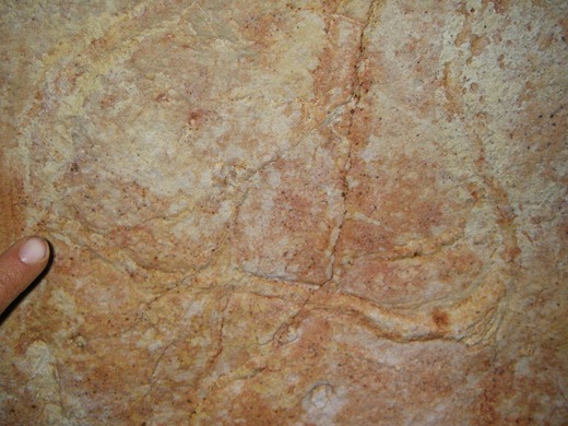
IMGP3586This is a trace fossil we found on one of the bedding plane ceilings – it’s where a sea creature was burrowing, or eating, or squirming along. (The paleontologist on the trip provided some more details, but I’ve unfortunately forgotten.) I had never seen a fossil in the wild before, so this was one of the trip’s highlights.
The first cave we went to is the most challenging cave I’ve been in so far, despite being entirely horizontal. The entrance is through a 100’ long crawlway – which sometimes is only 15” tall. (I definitely got stuck a couple times!) The floor of this crawlway is thickly coated with radon-laden dust: to avoid developing radioactive cavers, the BLM limits the time you can spend in the cave each year. We wore dust masks, to cut down on the amount of junk we inhaled, but that only served to make me more claustrophobic.  This was even more heightened by the heat – it was the warmest cave I’ve ever been in. It was a pretty rough beginning, but we were richly rewarded for all that effort with masses and masses of my favorite formation – helictites.
I didn’t have my camera that day, but I did the next day, when we visited the second cave. The day of this trip, snow was predicted, so we only spent the morning underground. (The road to the caves requires a 4wd vehicle generally, but is reportedly impassable in bad weather.) Luckily, as we ascended out of the cave right as the snow began falling, and made it to paved roads just in time.
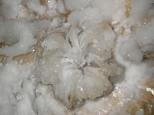
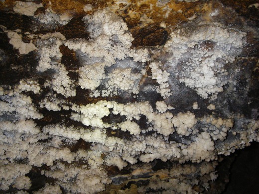
IMGP3529The caves have a wide variety of calcite formations, including helictites, rafts, and some really large cave popcorn. Additionally, they have gypsum flowers and crusts, epsomite crystal curls, and aragonite needles. These all form near each other, making for some truly impressive photographs.
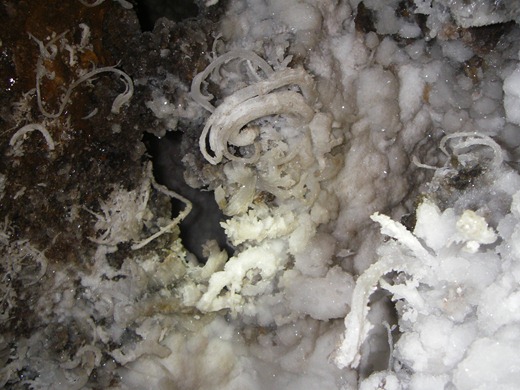
IMGP3514IMGP3523IMGP3555IMGP3571IMGP3535IMGP3588This last photograph is an interesting chunk of yellow and red crystal crust that was forming in a hole in the ground. I still don’t know what it is…
IMGP3556This is the underside of a rock, absolutely encrusted with black crystals.
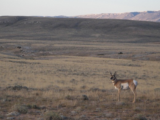
IMGP3470As we headed back to civilization, there was an antelope hanging out, clueless about what lay beneath its small cloven hoofs.

Monday, October 4, 2010

Stalagmite: definitely not limestone.


P1250097

In a lava cave roof, hot gases boil and push molten lava through cracks in the roof’s cooled crust. This lava can spooge out of its stalactite and drop to the ground, creating a stalagmite like this. This formation has a really nice metallic glaze to it, and I saw it in a cave near Bend, OR.

Saturday, May 22, 2010

Mt. St. Helens Pictures

May 18th was the 30th anniversary of the 1980 eruption of Mt. St. Helens!
Mt. St. Helens erupted prior to my birth, and I actually only saw it once before I turned 16. But, since then, I've been trying to make up for lost time. Living within a few hours of it makes that pretty easy!
These pictures are all from within the last year.

Memorial Day Weekend:
(I can't lie - this sign is always exciting!)

Still snow-covered.

Older flows contain the majority of Washington caves, including the ever-popular Ape Cave, open to tourists in the summer, and Gueller Ice Cave, a personal favorite.

August:
Without the snow, it's much easier to see the effects of the devastation.

Immediately after the eruption, there were large chunks of the mountain's glacier interspersed with this material. When these melted, they left behind hummocks, or piles of volcanic debris, including ash and large blocks from the cryptodome (the bulge.) The orange coloration is from geothermal alerting before the eruption - as they were heated and exposed to heated water and gases, the chemistry was altered.

Here you can see two different types of lava that were being mixed together when they erupted.

Spirit Lake: Even to this day, there's a layer of logs on the surface of the lake. They float around the lake when the wind blows.

September:
The wind picking up ash on the crater.

The lava domes! The old one is in the foreground, the new one in the background. Should you decide to climb Mt. St. Helens as a tourist, you'd hike up the back side, and summit at the crater wall seen in the background.

A concentrated pyroclastic density current near the crater, with hiking staff for scale.

Gas escape pipe in another pyroclastic flow. After the eruption, the gas that was in the flow needed a way to escape, and formed these pipes to the surface.

Spirit Lake, again, as seen from the Pumic Plain

Older uplifted flows

Pumice (with frog for scale)

This is a small hole dug into the pumice plain. You can see the layer of pyroclasic flow, with the pumice that was rafted to the top. Then, immediately on top is the layer of ash deposited from the ignimbrite cloud. (A layer of very fine ash that rose from the pyroclastic flow, then fell after the flow was deposited.)

Debris avalanche deposits are visible here, seen as the triangle of rising ground in the center. On May 18th, there was a 5.1 earthquake that released the largest landslide in history. This landslide released the pressure in the cryptodome, which trigged the eruption, and the pyroclastic flow. The pyroclastic flow traveled faster than the landslide (or debris avalanche) so the debris avalanche deposits are on top of the pyroclastic flow deposits.

When the pyroclastic flow overran a small lake, the water was flash boiled, creating an explosion pit. This one has been subsequently filled by water.

This is a sample of the dacite cryptodome from the 1980 eruption.
This is obviously my favorite.


References: I learned most of this in the class I took last summer, and the brief fieldwork I did with that professor. They were both pretty awesome experiences!

Wednesday, May 19, 2010

Jordan Craters

Unfortunately, my post on Mt. St. Helens isn't quite ready yet - I spent yesterday going to a lecture on geomorphology on Mars at the Northwest Geological Society in Seattle, and have a big test tomorrow to study for. (Those lectures make my month, and this one was really great. And an added perk: the school pays for our gas and the fancy buffet dinner. Swanky!)
In it's stead, here are some pictures from Jordan Craters, a small volcanic area in Eastern Oregon.

"The 27-square mile olivine basalt lava flow is estimated to be between 4000 and 9000 years old, based on the degree of lichen development on the rocks. An 18-acre flow within the field is thought to be less than 100 years old because not even lichens have begun to colonize."

It's fairly petite, as lava fields go, but really cute. (Bonus: the surrounding countryside is gorgeous.) This picture encompasses about half of the lava field. The foreground is a line of spatter cones. In the mid-ground, you can see the largest of the cinder cones - Coffee Pot Crater. The background are the lava flows themselves.

(Adapted from: Bruce R. Otto and Dana A. Hutchison, The Geology of Jordan Craters, Malheur County, Oregon, The Ore Bin, Vol. 39, No. 8, August 1977)

Coffee Pot Crater, from the rim. The detached wall block is on the right.

These are the reddest scoria I've ever seen - it really resembled raw hamburger at times. In other places, the scoria is a dark black. I hadn't seen this concentration of scoria before, but since it's a cinder cone, scoria is everywhere! It makes climbing out of the crater a bit tortuous.

This is the detached wall block, seen from the side.

The crater floor.


This is the side wall of the crater, with some stratigraphy present.

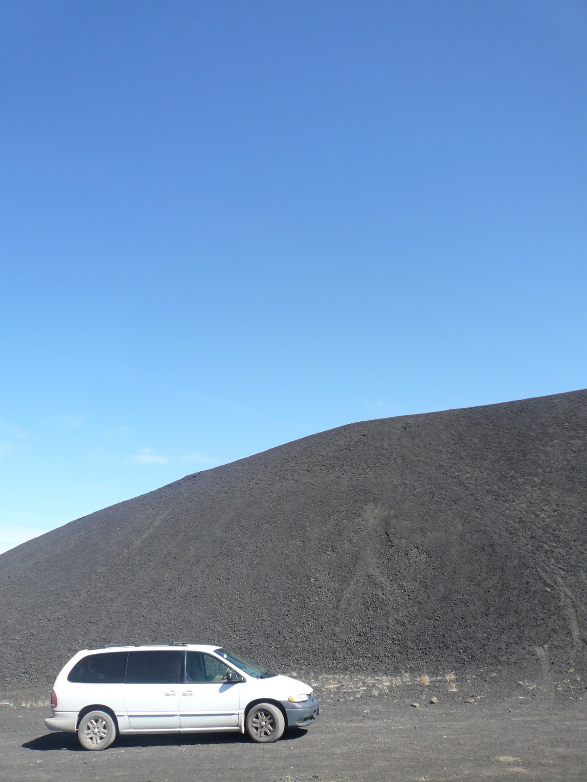
FYI: There are signs saying that all wheel drive is necessary, but if you're an awesome driver like me, the minivan'll make it.

View Larger Map
Unfortunately, we didn't get to explore the whole lava field, because I had to drop my mum off in Boise because her uncle died unexpectedly. After that, the stalwart minivan died in the deserts of Nevada. But that's another story.